PromoSM. Of course I googled it. Seems to be a marketing gimmick to get you more views. From what I read, using a service like that is against YouTube’s terms of service. The article I read said to report and delete the comment. When I reported it, YouTube deleted it.
Bought “Delphi and Object Pascal” course
This Udemy course is…new to me 🙂 “Learn To Program with Delphi and Object Pascal”, subtitle is “Master Object Pascal programming with Lazarus or Delphi”. I like that he emphasizes Lazarus also. Seems to be more about Object Pascal than Delphi. Which is what I’m most interested in. It has 4.3 stars, from 4900 students. And the creator of the course specifically says “Lazarus is great”.
How can I lose for $10.99? Regular price $94.99 😉

OOP is something I’ve dabbled with, on and off for years. But it doesn’t come 2nd nature to me. I can see benefits. But seldom use it. Actually only when I try and learn it. I expressed my views about it here. Still it would be nice to be more comfortable with it.
I can take it at my leisure. I’m in no hurry.
My next distro?
Today I’m thinking Linux Mint LMDE (Linux Mint Debian Edition). Uses Debian…not Ubuntu (which uses Debian as it’s base), as it’s base.
How I got my 1st computer job
I recently found a little notebook. That had info on my first computer job (not counting school) search path. I remember the Lady’s name from my notes…Pat Zinchak @ Snelling &Snelling (a headhunter). I contacted her because I saw she frequently posted DEC PDP jobs, which is what I was looking for. I was still in school, and she told me clients were looking for people with more experience. I thought OK…that’s…that. A short time later, maybe days or a week, she called me back and said she might be able to help me because she contacted my school, and got a good reports about me. I do remember going to an appointment she set up at Bass Ticket (like Ticketmaster), it’s in the notebook. No date but had to be early 1981. They had a PDP-11/45 and offered me $175 a week part-time as a operator. I passed on that offer because she soon sent me to a company in Fort Lauderdale that had a PDP-11/70 and Data General Nova 3 (which I had nothing to do with) and was full time. I accepted that job (my 2nd job apply), and worked there many years.
I tried to find info on Bass Ticket. So far, all I’ve found in Wikipedia is… “In the 1970s, Jerry Seltzer co-founded Bay Area Seating Service (BASS) Tickets, a San Francisco Bay Area computerized ticket service.” Odd… could I be mistaken? I remembered the name Bass Ticket and it’s in my old notebook. I went to some company, that I’ve assumed all these years was Bass Ticket, where they had a DEC minicomputer, and they made me that offer. I didn’t really go to concerts back then, so it’s not like I’d make up such a random name. Is it possible that it was a satellite branch, that wasn’t around long enough to matter?
I also googled the address I have written down… 99 NW 183rd Street. A picture shows Miami Gardens Office Center. Yelp says… Renting office space. I certainly don’t remember a office building I saw once over 40 years ago. But my memory seems to remember it was in a building that contained different offices.
Out of curiosity I googled Pat, and found “Patricia Ann Zinchak”. I assume it’s her because of her unusual last name and local. Unfortunately she died Sep 11th, 2021. It seems like just yesterday she was sending me out on interviews. RIP Pat, you played an important part in starting my career.
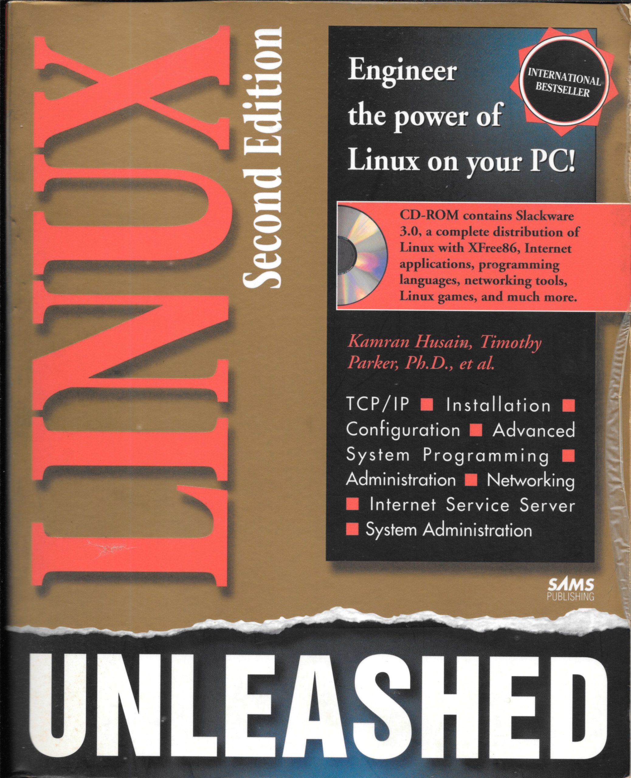
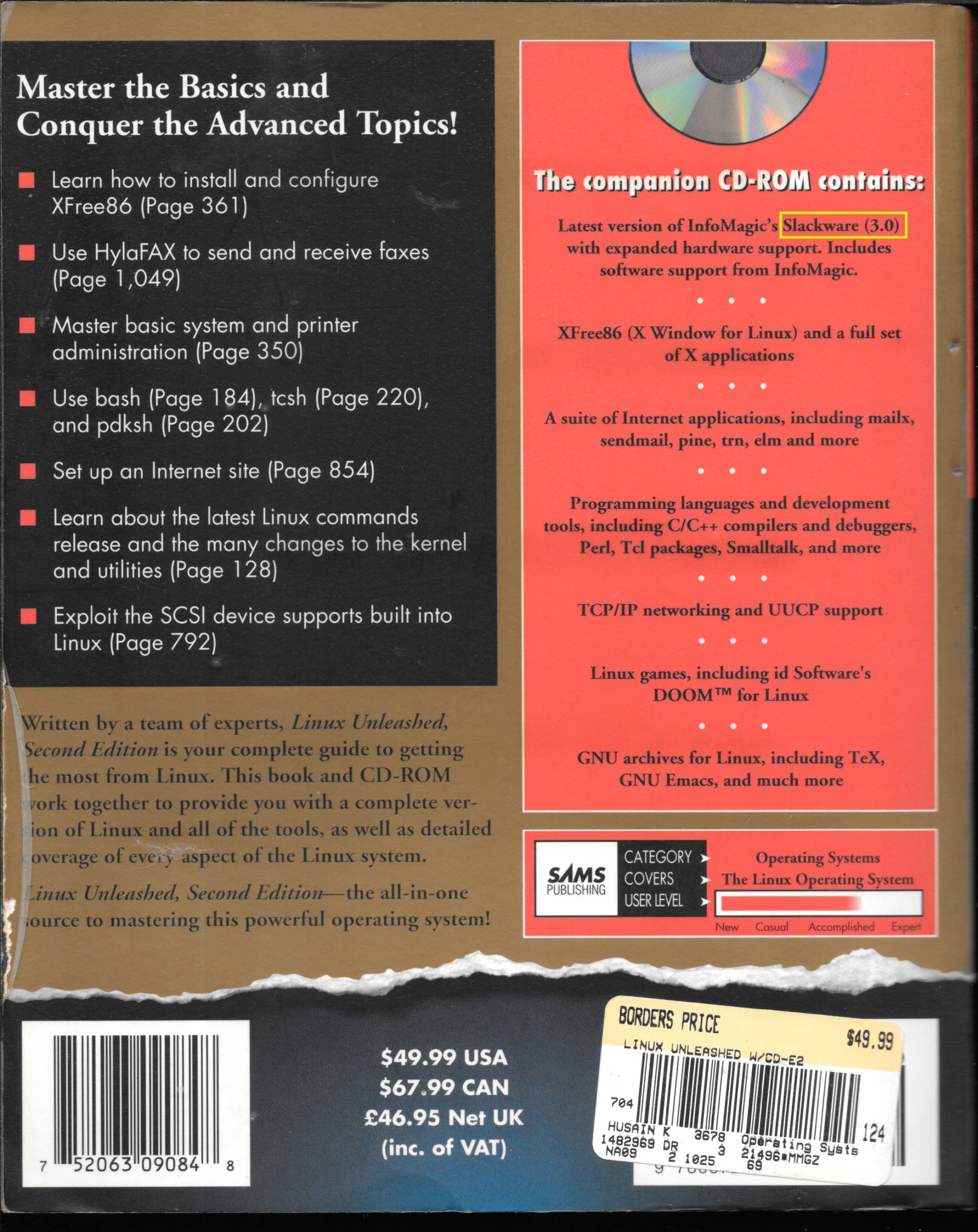
My 1st Linux Distro
Slackware 3.0 – From a book (over 1.100 pages). This book has a 1996 copyright.
Images in Lazarus
After I found the TImage object in the Additional tab, I Assumed this would be easy. But I had to google. The last comment below was how tried to do it at 1st…Lazarus, didn’t like. It’s been awhile. I guess I’m not thinking in Lazarus/Pascal. Anyway the below code works.
  { TForm1 }

  TForm1 = class(TForm)
    Button1: TButton;
    Image1: TImage;
    procedure Button1Click(Sender: TObject);
    procedure FormCreate(Sender: TObject);
    procedure Image1Click(Sender: TObject);
  private
    var pic: TPicture;
...
procedure TForm1.Button1Click(Sender: TObject);
begin
     pic:=TPicture.Create;
     pic.LoadFromFile('PDP-11_1200x600.jpg');
     image1.Picture:=pic;
//   image1.Picture:='PDP-11_1200x600.jpg';
end;
Also, at one point in my testing, I wanted to remove a picture, I had loaded at design time. But as you can see below “Clear” is grayed out. Somewhere along the line I looked at it again, and it wasn’t grayed, and I could “Clear” it.
Maestro
A Unix-like kernel and operating system written from scratch in Rust. Should look into this.
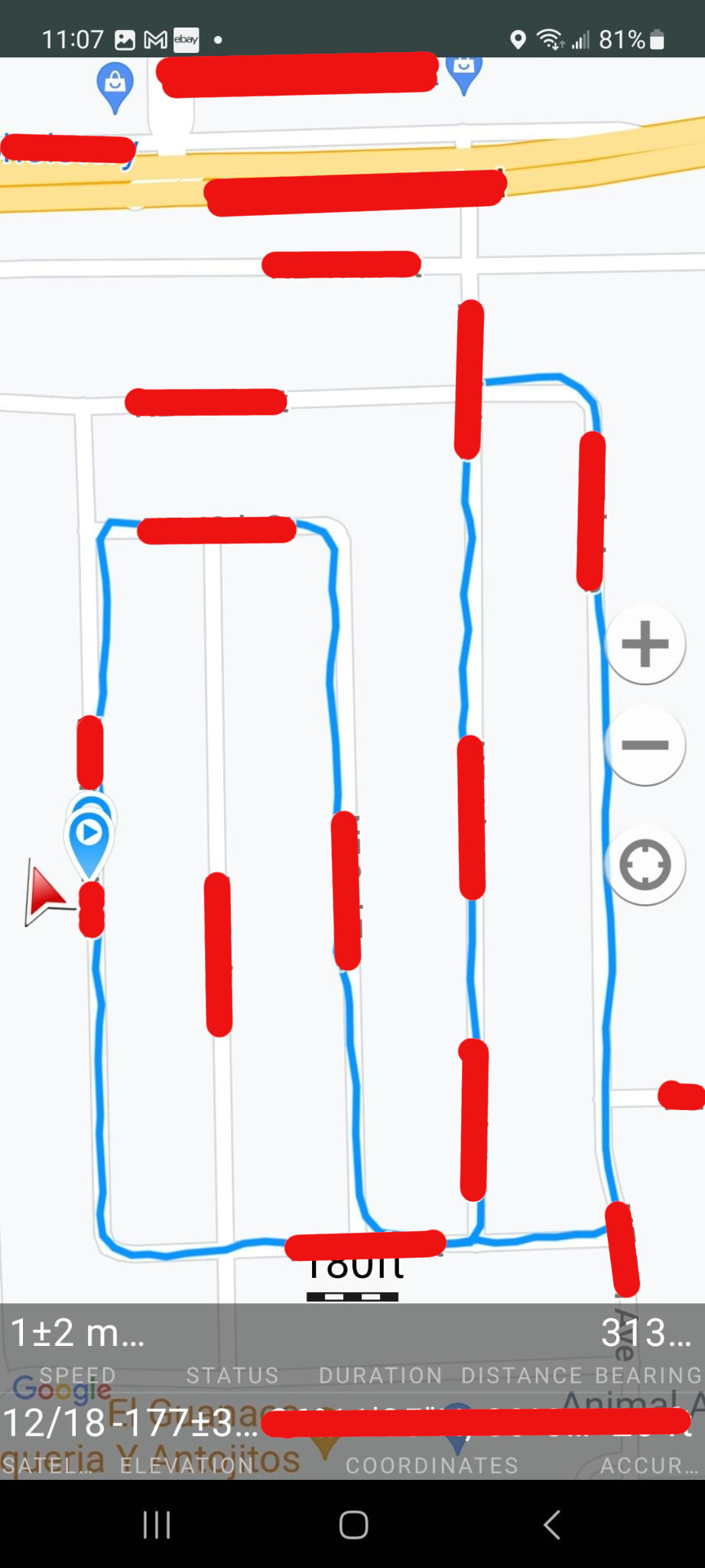
Geo Tracker
Android app that uses GPS to track your trip. This is my interpretation of how it works, so my wording might not be correct. Basically you press the + to start a course. Then you press a big red circle for record. I mistakenly thought was some way-point in the beginning. Then you proceed on your course. When finished you press the stop record button. You are then shown the screens below.
Why?
Me and my daughter rented bikes (for 2hrs) at a big park with lots of random trails, that covered many acres. After an 1.5hrs we decided we needed to head back. However we made a lot of random turns. And on the way back some of it seemed familiar. But a lot of it was guess’s. Do we turn here? If so…right or left? Or do we go straight? Well after much trial and error and luck, perhaps even God’s help…we made it back. But it could have been a problem.
So knowing my phone has GPS. I looked for a solution and found Geo Tracker
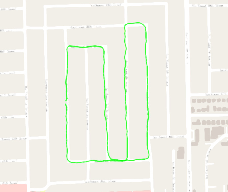
So below is the results of a test of the app. I’ve hidden (in red) location info to thwart my enemy’s effort to locate my secret lair 🙂 . So below is a recording of a bike ride in my neighborhood. I did it for 2 reasons.
- To test the app. It’s kinda nice to try it out before you hope to rely on it.
- I wanted to to see how reliable the GPS data is. Which really kinda goes with reason 1.
Map (on Android).
It’s hard telling the direction on the map if you start/stop at the same place. However for this map I also added direction arrows, for my path. If your lost on a trail, I assume it will be obvious the path you took. It seems like that wouldn’t be hard to add a direction arrow every little bit. because it’s all latitude/longitude. For example the map below I went South (down) to start. But did I go turn 1st? North (up) on the last street or the one before it? It might seem more logical to assume I went North on the last street first. And I did when I first started riding this course. But for reasons you can’t tell from this map, traffic wise it was safer to the direction I show below.
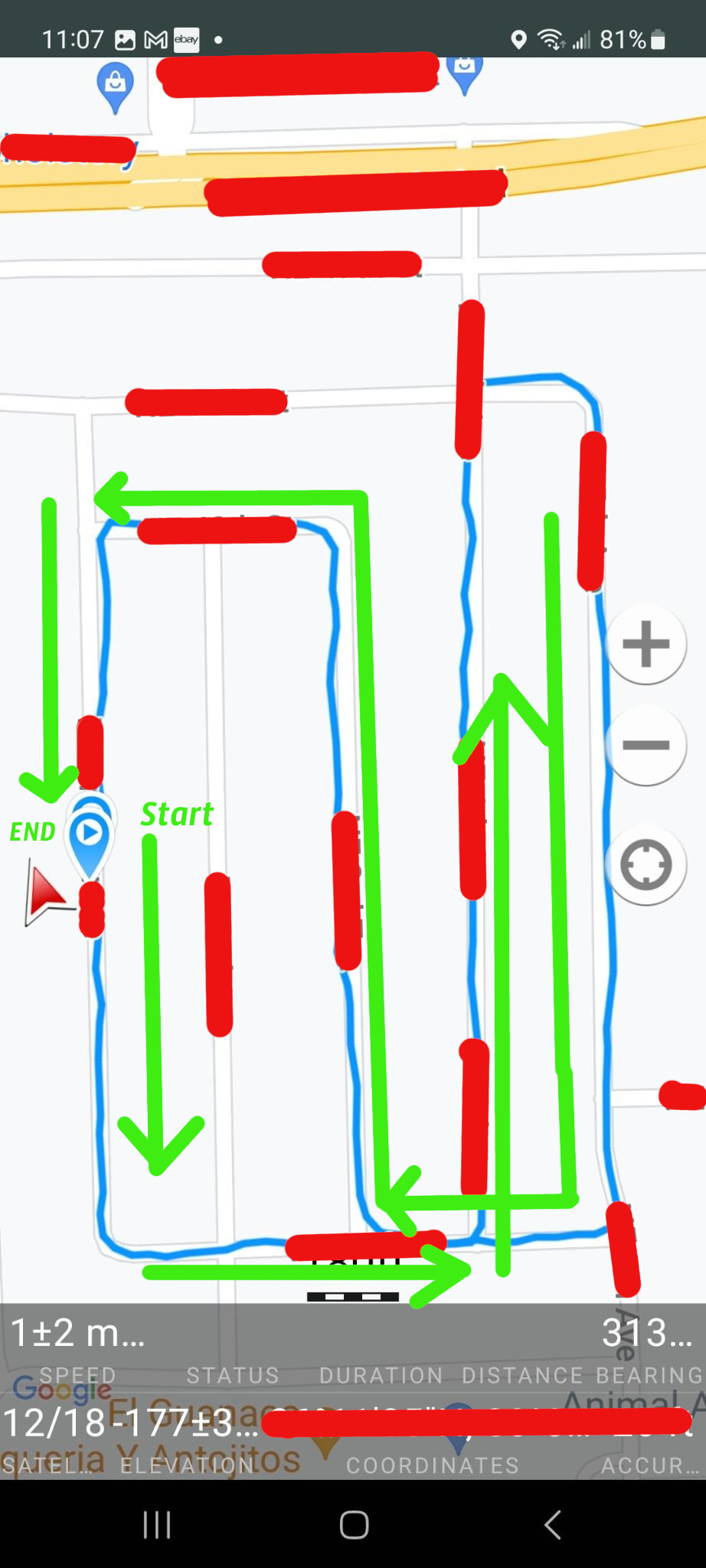
I can confirm that the map is correct! Note the red arrow on the far right. It’s actually a live compass that points North, not necessarily the direction you’re going. So If I walk South (bottom), after the recording has stopped, the arrow will follow me on the blue line, but it will still be pointing North.
Stats
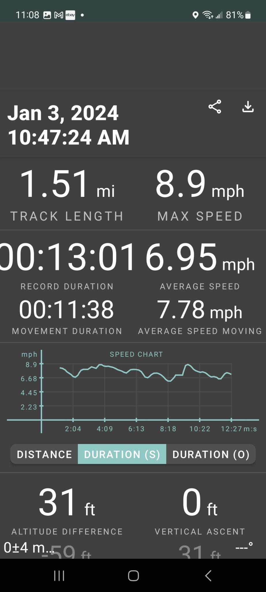
The app allows you to export the data in a few different formats. I didn’t know one from the other so I chose GPX. Then I looked for something on Linux that could do something with it. Right off the bat I found GPX Viewer. So I fed the info into it and got this. Actually this is cropped and blurred (thank goodness for blur. It would take a lot of editing to hide all this data) from a much larger map with even more detail than from the above Android app. The neighborhood looks to match the Android app. So that’s pretty cool.
At the top left of the map (see below) there are some stats. The distance of 2.44km matches 1.5 miles. This distance also matches my car odometer where I previously drove my course by car. I see some discrepancies. First the time is off by +5 hrs. Also the speed looks low to me. I’m on a bike and have a hurt wrist. So I’m not biking at my best, however an average speed of 3.27 looks slow. Then again it doesn’t say MPH it says m/s whatever that means. The app average speed of 7.78 mph looks more realistic. I see no settings menu option to change anything. Perhaps there is a config file somewhere.

Niklaus Wirth died today
He developed Pascal along with other programming languages. Isn’t it ironic that I just started playing with Pascal again.