Android app that uses GPS to track your trip. This is my interpretation of how it works, so my wording might not be correct. Basically you press the + to start a course. Then you press a big red circle for record. I mistakenly thought was some way-point in the beginning. Then you proceed on your course. When finished you press the stop record button. You are then shown the screens below.
Why?
Me and my daughter rented bikes (for 2hrs) at a big park with lots of random trails, that covered many acres. After an 1.5hrs we decided we needed to head back. However we made a lot of random turns. And on the way back some of it seemed familiar. But a lot of it was guess’s. Do we turn here? If so…right or left? Or do we go straight? Well after much trial and error and luck, perhaps even God’s help…we made it back. But it could have been a problem.
So knowing my phone has GPS. I looked for a solution and found Geo Tracker
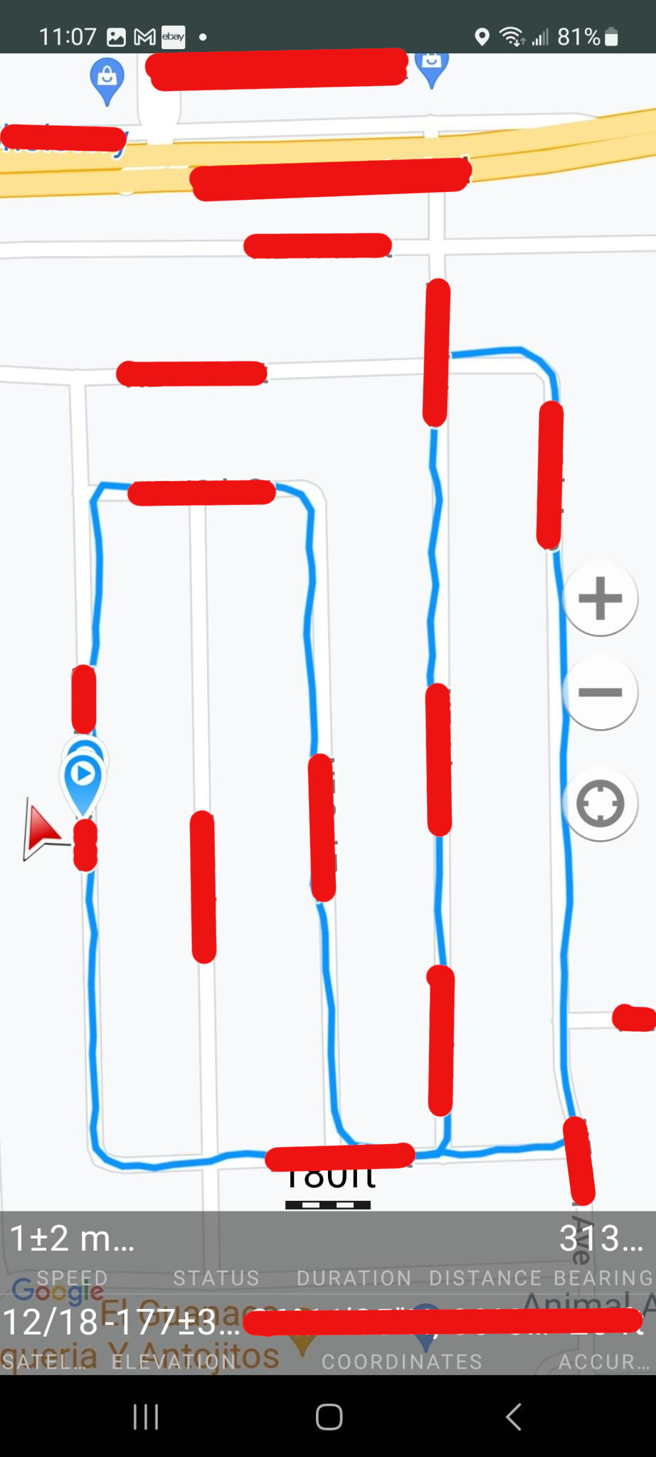
So below is the results of a test of the app. I’ve hidden (in red) location info to thwart my enemy’s effort to locate my secret lair 🙂 . So below is a recording of a bike ride in my neighborhood. I did it for 2 reasons.
- To test the app. It’s kinda nice to try it out before you hope to rely on it.
- I wanted to to see how reliable the GPS data is. Which really kinda goes with reason 1.
Map (on Android).
It’s hard telling the direction on the map if you start/stop at the same place. However for this map I also added direction arrows, for my path. If your lost on a trail, I assume it will be obvious the path you took. It seems like that wouldn’t be hard to add a direction arrow every little bit. because it’s all latitude/longitude. For example the map below I went South (down) to start. But did I go turn 1st? North (up) on the last street or the one before it? It might seem more logical to assume I went North on the last street first. And I did when I first started riding this course. But for reasons you can’t tell from this map, traffic wise it was safer to the direction I show below.
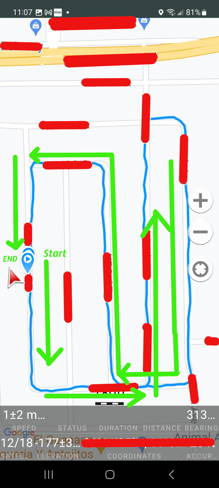
I can confirm that the map is correct! Note the red arrow on the far right. It’s actually a live compass that points North, not necessarily the direction you’re going. So If I walk South (bottom), after the recording has stopped, the arrow will follow me on the blue line, but it will still be pointing North.
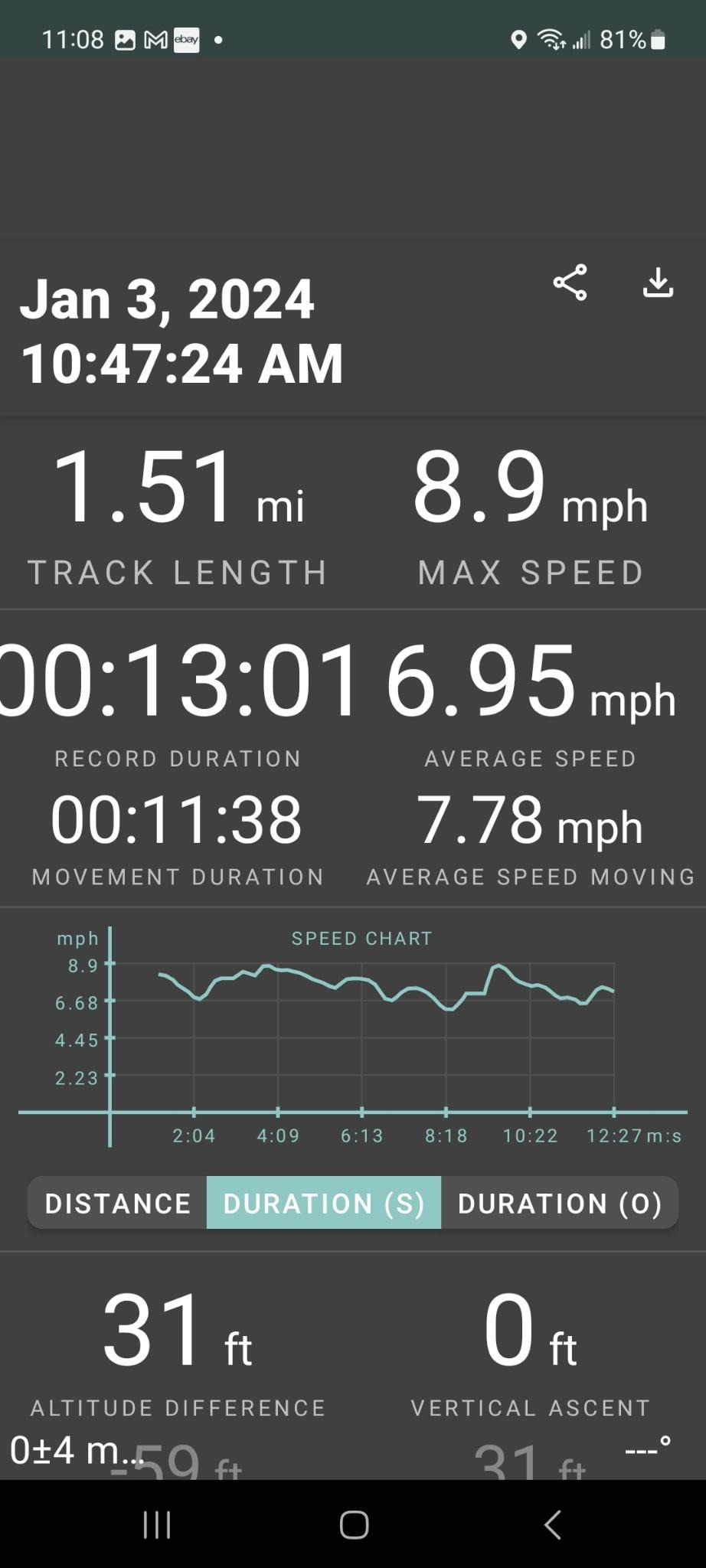
Stats
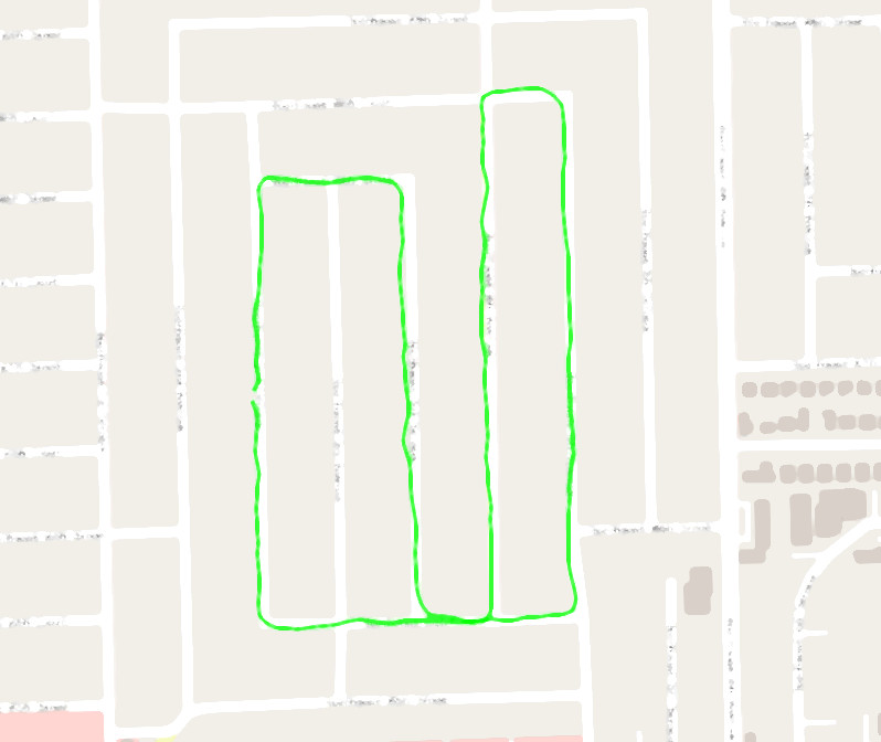
The app allows you to export the data in a few different formats. I didn’t know one from the other so I chose GPX. Then I looked for something on Linux that could do something with it. Right off the bat I found GPX Viewer. So I fed the info into it and got this. Actually this is cropped and blurred (thank goodness for blur. It would take a lot of editing to hide all this data) from a much larger map with even more detail than from the above Android app. The neighborhood looks to match the Android app. So that’s pretty cool.
At the top left of the map (see below) there are some stats. The distance of 2.44km matches 1.5 miles. This distance also matches my car odometer where I previously drove my course by car. I see some discrepancies. First the time is off by +5 hrs. Also the speed looks low to me. I’m on a bike and have a hurt wrist. So I’m not biking at my best, however an average speed of 3.27 looks slow. Then again it doesn’t say MPH it says m/s whatever that means. The app average speed of 7.78 mph looks more realistic. I see no settings menu option to change anything. Perhaps there is a config file somewhere.
